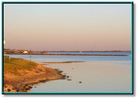
Matagorda Bay and Nearby Coastal Waters
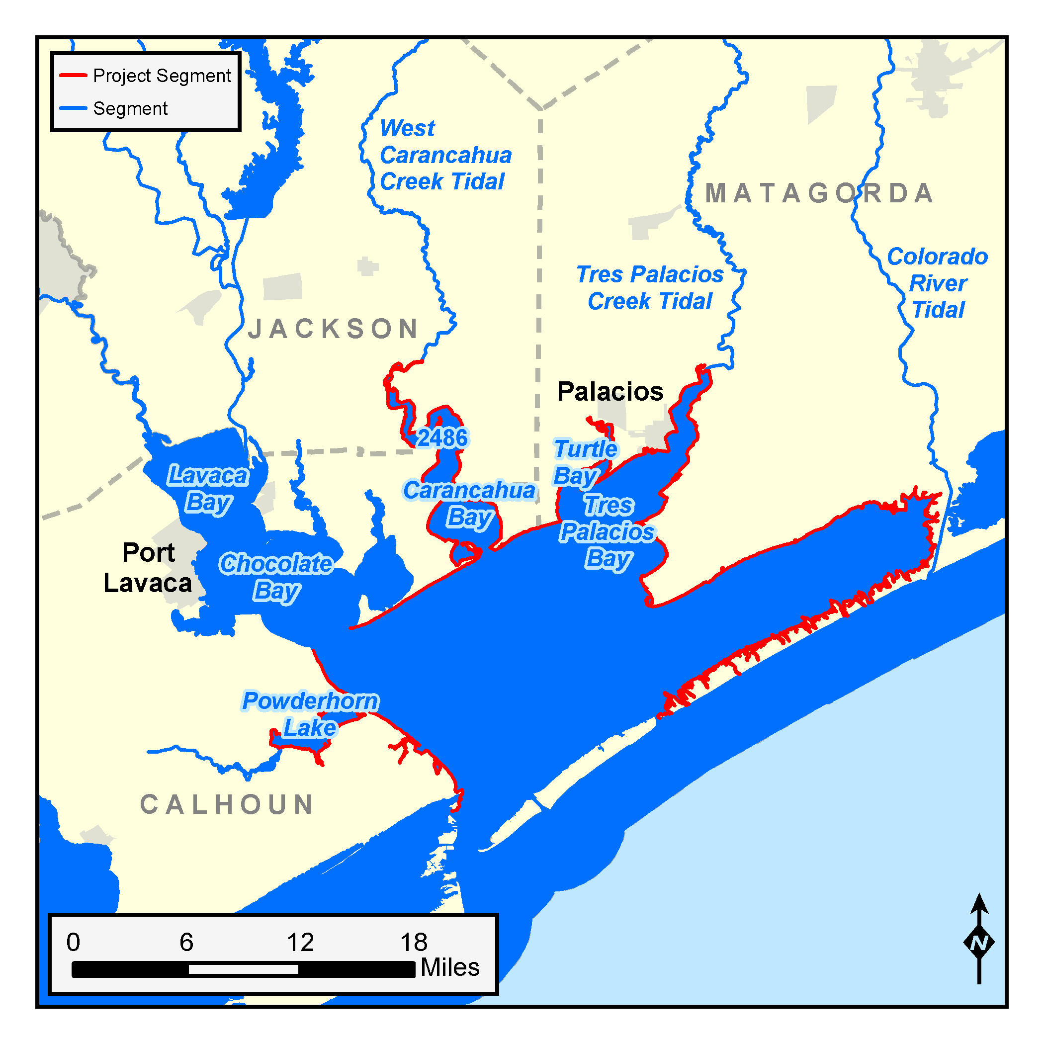


Watershed Counties: Matagorda, Jackson, Calhoun, Refugio, and San Patricio
Parameters: Dissolved Oxygen, pH
River Basins: Bays and Estuaries, Colorado-Lavaca Coastal Basin, San Antonio-Nueces Coastal Basin
Segments: 2451, 2452, 2456, 2483A
On this page:
- Background and Goals
- Watershed Description
- Public Participation
- Status
- Project Documents
- For More Information
Background and Goals
Water quality testing from before 2004 found that dissolved oxygen and pH concentrations were sometimes outside the ranges needed to support a healthy aquatic community in several bays and a harbor on the Texas coast. The affected segments were:
- With low dissolved oxygen levels:
- Matagorda Bay/Powderhorn Lake (Segment 2451)
- Tres Palacios/Turtle Bay (Segment 2452)
- Conn Brown Harbor (Segment 2483A)
- With pH levels outside the desirable range:
- Carancahua Bay (Segment 2456)
Oxygen gas, which dissolves in water, is essential for the survival of aquatic life. While the amount of dissolved oxygen in water fluctuates naturally, various human activities can cause unusually or chronically low dissolved oxygen levels, which may harm fish and other aquatic organisms.
The pH values are equally important to the survival of aquatic life. All biological processes are dependent on pH, which is a measure of the hydrogen ion activity in a solution. pH values not within the desirable range indicate that there may be pollutants causing the water to become unbalanced. Water that is to acidic or too basic could cause harm to aquatic organisms.
The goal of this project was to assess water quality conditions in greater depth and ensure the bays and harbor sustain a healthy aquatic community.
Watershed Description
These coastal waters represent an ecologically important part of the Texas coast that includes both freshwater and saltwater marshes, along with open estuaries. The area has diverse uses including recreation; production of oil and gas; cultivation of rice, sorghum, and cotton; livestock grazing; and commercial and residential developments.
The watersheds of the bays and lake lie along the coastal plain between the Colorado and Lavaca Rivers on the Texas Gulf Coast. Tres Palacios Creek is the primary source of freshwater to this area. The watersheds include portions of Matagorda, Wharton, Jackson, and Calhoun counties, along with the cities of Palacios, Point Comfort, and La Ward.
Conn Brown Harbor is also on the coastal plain, but between the San Antonio and Nueces Rivers. The primary sources of freshwater to the area are the Mission and Aransas rivers. This watershed includes portions of Aransas, Refugio, Goliad, Bee, and San Patricio counties. Cities within the area include Rockport, Refugio, Ingleside, Aransas Pass, Beeville, Portland, Sinton, Taft, and Bayside.
Public Participation
Project personnel informed the public about this project through a series of public meetings. Staff from the University of Texas Marine Science Institute (UTMSI) and Texas A&M University-Corpus Christi assisted TCEQ with identifying interested stakeholders and organizing meetings. All the meetings were open to everyone.
Status
TCEQ initiated this project in 2004 in cooperation with UTMSI in Port Aransas. UTMSI completed all data collection in October 2006. Analysis of this more detailed data set showed that dissolved oxygen and pH levels in the bays and harbor were within or better than the ranges necessary to support a healthy aquatic community. As a result, TCEQ removed the water bodies from the state’s list of impaired waters.
Project Documents
- Protecting Tres Palacios Bay — Brochure
- Tres Palacios Bay TMDL Source Assessment Report
- Matagorda Bay and Nearby Coastal Waters Dissolved Oxygen and pH TMDL Assessment Report
Contact the TMDL Program
Please email tmdl@tceq.texas.gov, and mention the Matagorda Bay project in the subject line. Or call us at 512-239-6682.
![]() Back to top
Back to top