Sam Rayburn Reservoir


Counties: Angelina, Cherokee, Jasper, Newton, Nacogdoches, Rusk, Sabine, San Augustine, Smith
Parameters: Aluminum, pH, dissolved oxygen, Impaired Fish Community
Basin: Neches River
Segments: 0610, 0615
On this page:
- Background and Goal
- Watershed Description
- Status
- Public Participation
- Project Documents
- Contact the TMDL Program
Background and Goal
As early as 2000, data indicated that conditions were not optimal for aquatic life in six areas of the reservoir because of low concentrations of dissolved oxygen. One area of the reservoir had aluminum concentrations that were sometimes too high to provide healthy conditions for aquatic life. And in one other area of the reservoir, the pH was occasionally too high or too low.
Watershed Description
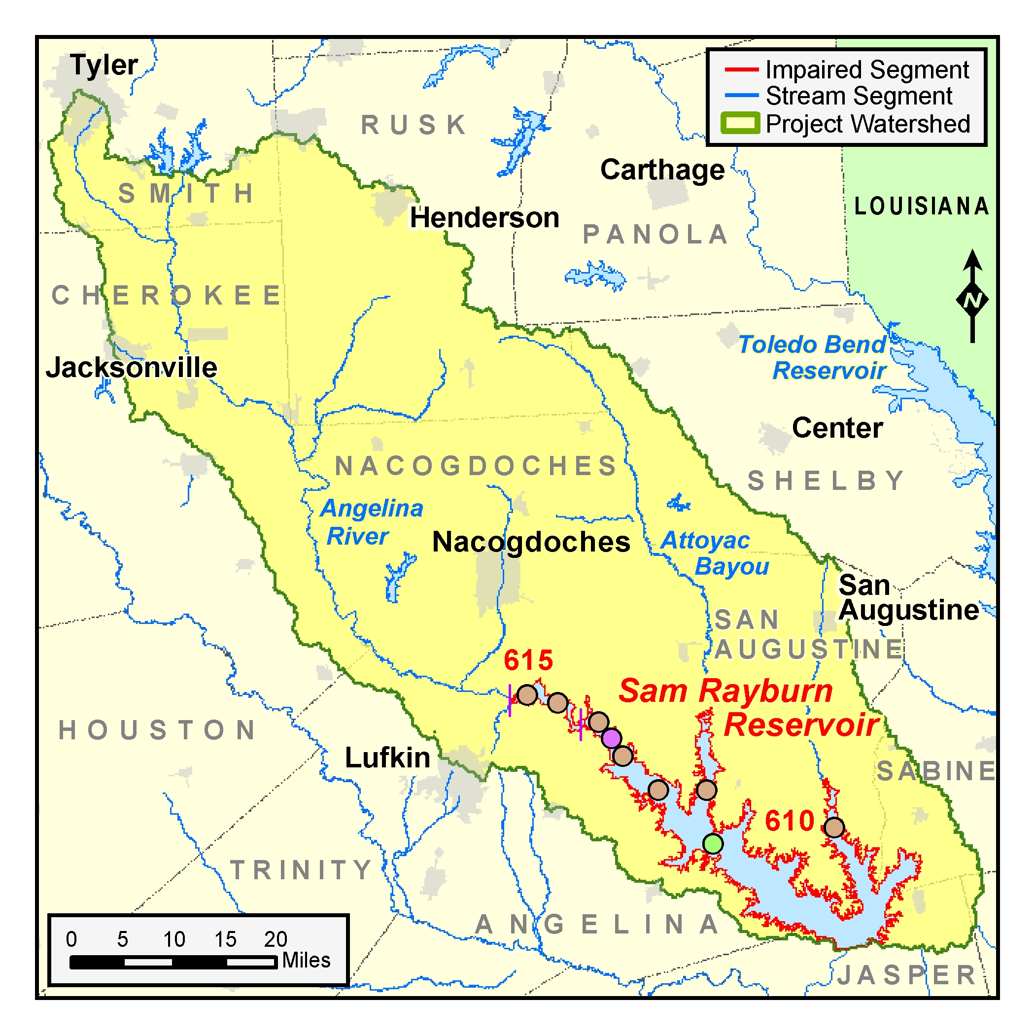
Sam Rayburn Reservoir is in the eastern part of the state and is a very popular destination for fishing and boating. The lake was created in 1965 to control floods, generate hydroelectric power, and conserve water for municipal, industrial, agricultural, and recreational uses. It holds 114,500 acres of water and has 560 miles of shoreline. The reservoir’s watershed drains about 1,385 square miles.
At the time of this project, Sam Rayburn Reservoir had two classified segments—Sam Rayburn Reservoir (0610) and Angelina River/Sam Rayburn Reservoir (0615). Sam Rayburn Reservoir impounds water from the Angelina River and Attoyac Bayou. Segment 0615 is the riverine portion of Sam Rayburn Reservoir upstream of Marion’s Ferry to above its confluence with Papermill Creek.
The watershed includes all or portions of the cities of Appleby, Broaddus, Bronson, Browndell, Chireno, Garrison, Huntington, Jacksonville, Lufkin, Nacogdoches, Pineland, San Augustine, Tyler, and Zavalla.
Status
TetraTech did the technical work for the project, which was initiated in July 2002 and completed in May 2003. TetraTech evaluated all existing sampling data, including those used to develop the 2002 list of impaired waters. Based on their study, TCEQ determined that there were no impairments that required a TMDL. The project was completed in May 2003.
Public Participation
TCEQ worked with the Angelina-Neches River Authority and the Lower Neches Valley Authority of the Clean Rivers Program to inform the public about this project.
TCEQ held a meeting on May 15, 2003, to inform the public of the project’s status and to solicit public opinion. A summary of the meeting and the presentation materials are available below.
Project Documents
Contact the TMDL Program
Please e-mail tmdl@tceq.texas.gov, and mention the Sam Rayburn Reservoir project in the subject line. Or call us at 512-239-6682.