Nueces Bay
Counties: Nueces, San Patricio
Parameter: Zinc in oyster tissue
Basins: Bays and Estuaries, San Antonio–Nueces Coastal, Nueces River, Nueces–Rio Grande Coastal
Segment: 2482
On this page:
- Background and Goals
- Watershed Description
- Status
- Public Participation
- Adopted TMDL
- Approved I-Plan
- Reports
- Contact the TMDL Program
Background and Goals
The Department of State Health Services (DSHS) has banned harvesting of oysters throughout Nueces Bay (Segment 2482) because of high concentrations of zinc in oyster tissues.
Zinc is a trace element naturally present in living tissue, and essential to the healthy function of the body. Zinc plays an important role in metabolism, tissue repair, cell replication, and growth. However, like all trace elements, zinc is toxic if consumed in excess over an extended period.
TCEQ initiated a TMDL project to determine the measures necessary to restore water quality in the bay. The goal of a TMDL is to determine the amount (or load) of a pollutant that a body of water can receive and still support its designated uses. This allowable load is then allocated among the categories of sources within the watershed, and stakeholders work with the state to develop an I-Plan with measures that reduce pollutant loads.
Watershed Description
Nueces Bay has an area of 28.9 square miles and drains the Nueces River Basin (16,950 square miles), along with portions of the San Antonio-Nueces and Nueces-Rio Grande Coastal Basins. Nueces Bay is a shallow, secondary bay that receives freshwater from the Nueces River and exchanges saline water with Corpus Christi Bay. The climate in this region is arid most of the time, except when influenced by freshets and tropical storms, which often result in flooding.
Principal tributaries of the Nueces River include the Atascosa and Frio rivers. The western part of the Edwards Aquifer lies within the river basin, along with two major reservoirs—Choke Canyon Reservoir and Lake Corpus Christi. The western part of Corpus Christi is the only major metropolitan area within the river’s watershed.
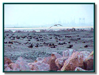
Nueces Bay has economic and ecologic importance to the surrounding region. Economic activities in and around the bay include petrochemical refining and production, agriculture, manufacturing, recreation, maritime commerce, and tourism. Ecologically, Nueces Bay is home to many plants and animals, and plays a role in water purification and storm protection.
Status
As of its last assessment in November 2020, the Texas Department of State Health Services (DSHS) still classifies Nueces Bay as restricted for oyster harvesting. Learn more about risk assessments and classifications of shellfish harvesting areas on DSHS's webpage Shellfish Harvesting Areas and Maps . Lear more about the possible risks of eating oysters from restricted areas at Risks of Eating Shellfish .
Public Participation
The TMDL Program worked with the existing forum of the Coastal Bend Bays and Estuaries Program (CBBEP) to involve area stakeholders in this project.
Adopted TMDL
The commission adopted this TMDL on November 1, 2006. It was approved by the EPA on December 15, 2006, at which time it became part of the state's Water Quality Management Plan.
-
One Total Maximum Daily Load for Zinc in Oyster Tissue in Nueces Bay
Segment 2482 - Response to Public Comment on the TMDL
Revisions to TMDLs
From time to time, it is necessary to revise TMDLs to account for changing conditions in the watershed. Revisions to the load allocations in TMDLs are made via the state’s Water Quality Management Plan (WQMP), which is updated quarterly.
The WQMP provides projected effluent limits for use in planning and permitting activities under the Texas Pollutant Discharge Elimination System (TPDES). The TCEQ reviews all applications for new and amended permits for conformance with applicable portions of the WQMP, including adopted TMDLs.
Updates
Updates are made to account for changing conditions in the watershed, such as new or revised wasteload allocations, permits that have been canceled or have expired, or changed facility names. Updates use the same units of measure as the original TMDL.
- January 2020, Appendix V, page 18
- July 2012, Appendix III, page 14
- April 2010, Appendix II, pages 16-17
WQMP updates may be viewed in person at the TCEQ Library, Building A, 12100 Park 35 Circle, Austin, Texas. Electronic versions of updates published from 2014 through the present are available on the Texas State Library and Archives Commission website .
For WQMP updates prior to 2014, use the TRAIL Search the TCEQ engine as outlined below. The main search box on the page will only conduct a simple search with no exclusionary parameters and should not be used.
- First, limit your search to TCEQ only. Do this via the advanced search feature on the left of the page. To limit a search to TCEQ content, enter “www.tceq.texas.gov” or “www.tceq.state.tx.us” into the “From the Host” search box.
- Refine your search to narrow down results. The other search boxes on the left of the page allow for search terms to be included, excluded, or used in an exact phrase search. Date ranges can be used as well.
Approved I-Plan
The commission approved the I-Plan on October 24, 2007.
- Implementation Plan for One Total Maximum Daily Load for Zinc in Oyster Tissue, Nueces Bay, Segment 2482
- Response to Public Comment on the I-Plan
Reports
Technical Support Document
Annual Reports
- 2005 Year 1: Nueces Bay TMDL Project Phase I – Interim Implementation Monitoring Data Report
- 2006 Year 2: Nueces Bay TMDL Project Phase II - Interim Implementation Monitoring Data Report
- Year 3: No viable oysters harvested 2007-2009. Discussed in Phase IV report.
- 2010 Year 4: Nueces Bay TMDL Project Phase IV - Implementation Effectiveness Monitoring Report
- 2011 Year 5: Nueces Bay TMDL Project Year-five - Implementation Effectiveness Monitoring Data Report
- 2012 Year 6: Nueces Bay TMDL Project – Year-six - Implementation Effectiveness Monitoring Data Report
- 2013 Year 7: Nueces Bay TMDL Project – Year-seven - Implementation Effectiveness Monitoring Data Report
Miscellaneous Reports
- Port Industries of Corpus Christi Meeting Presentation, January 19, 2006
-
Quantitative Risk Characterization, 2005
A report by the Texas Department of State Health Services (formerly the Department of Health) evaluating the risk to consumers from eating shellfish caught in Nueces Bay. - Quantitative Risk Characterization, 2003
Contact the TMDL Program
Please email tmdl@tceq.texas.gov, and reference the Nueces Bay project in the subject line. Or call us at 512-239-6682.


 Back to top