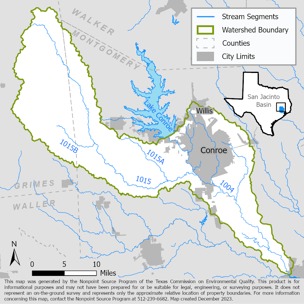
West Fork of the San Jacinto River and Lake Creek: Watershed Protection Plan Development
The Houston-Galveston Area Council developed a watershed protection plan for the watershed of the West Fork San Jacinto River below Lake Conroe and characterizations of the Spring Creek and Cypress Creek watersheds.

On this page:
Project Area
River Basin: San Jacinto River Basin
Water Bodies: West Fork San Jacinto River (1004), Lake Creek (1015), Spring Creek (1008), Cypress Creek (1009)
Location: Montgomery, Waller, Grimes, and Harris counties
Background
The West Fork of the San Jacinto River is a tributary to Lake Houston, a drinking water source for the Houston metropolitan area. Portions of the river did not meet state water quality standards for the primary contact recreation use due to high levels of bacteria and were listed as impaired in the 2014 Texas Integrated Report of Surface Water Quality.
In addition to not meeting water quality standards, portions of West Fork's primary tributaries – Spring Creek, Cypress Creek, and Lake Creek – had some combination of listed concerns for depressed dissolved oxygen, excess nutrients, and impaired fish and microbenthic communities.
These watersheds have been included in previous watershed planning efforts that include the Bacteria Implementation Group’s Implementation Plan for Houston Area Total Maximum Daily Load (TMDL), the Implementation Plan for Seventy-Two TMDLs for Bacteria in the Houston-Galveston Region, and the TMDL for Bacteria in the East and West Forks of the San Jacinto River.
Project Description
The Houston-Galveston Area Council (H-GAC) developed a watershed protection plan (WPP) with extensive stakeholder involvement to identify sources of pollution to the water bodies, determine the contaminant reductions necessary to meet state water quality standards, and recommend management measures to improve water quality. The West Fork San Jacinto River and Lake Creek WPP was accepted by the U.S. Environmental Protection Agency in 2019.
In addition to the West Fork San Jacinto River and Lake Creek WPP, H-GAC also collected, analyzed, and evaluated the results of monitoring data and conducted modeling to characterize the conditions and sources of pollutant loading in the watersheds of Spring Creek and Cypress Creek watersheds.
H-GAC also held multiple outreach and education events in the watershed including Texas Stream Team Citizen Scientist Monitoring Trainings through Texas State University, and Texas Watershed Stewards.
For More Information
Houston-Galveston Region: Implementation Plans and TMDLs
To find out more about the NPS Program, call 512-239-6682 or email us at nps@tceq.texas.gov.

 Back to top